Problem
Within a university group project, we were tasked with exploring a problem tied to one of the UN Sustainable Development Goals. Passionate about ocean safety, our team focused on the most significant beach safety threat in Australia: rip currents. Rips are responsible for half of all swimming deaths at Australian beaches, and over three quarters of annual beach rescues. Despite this, fewer than half of beachgoers can correctly identify a rip, even those who are confident that they could.
50,000
Potential people engaged each year
20,000
Potentially people informed with valuable rip safety information
15
Potential lives saved annually
Process
We conducted 50+ surveys, 10 interviews, and 5 contextual observations to uncover how beachgoers and lifeguards think about risk, confidence, and safety at the beach:
Confidence ≠ Competence: Many participants - particularly young men - displayed a strong sense of confidence in their swimming skills, often at odds with their actual ability. This bravado masked a lack of awareness about rip currents and their danger.
Beach Literacy Gap: We uncovered a cultural divide in safety awareness. Those raised outside coastal Australia were far less likely to recognise warning signs or understand rip behaviour, regardless of overall swimming ability.
Signage is Failing: The most at-risk beachgoers weren’t just uninformed — they were actively ignoring safety signs. The reason? “Too much text” and “not visually engaging.” Current signage simply isn’t speaking their language, and it's costing lives.
Target Users
Primary: People from non-coastal regions or diverse cultural and linguistic backgrounds with little to no beach safety knowledge.
Secondary: People familiar with basic beach safety (e.g. swimming between the flags) but lack confidence in swimming at unpatrolled beaches.
Problem Statement
How can we improve rip current and beach safety education for people visiting unpatrolled Australian beaches; especially those from non-coastal areas or diverse language backgrounds with little beach safety knowledge?
Concept
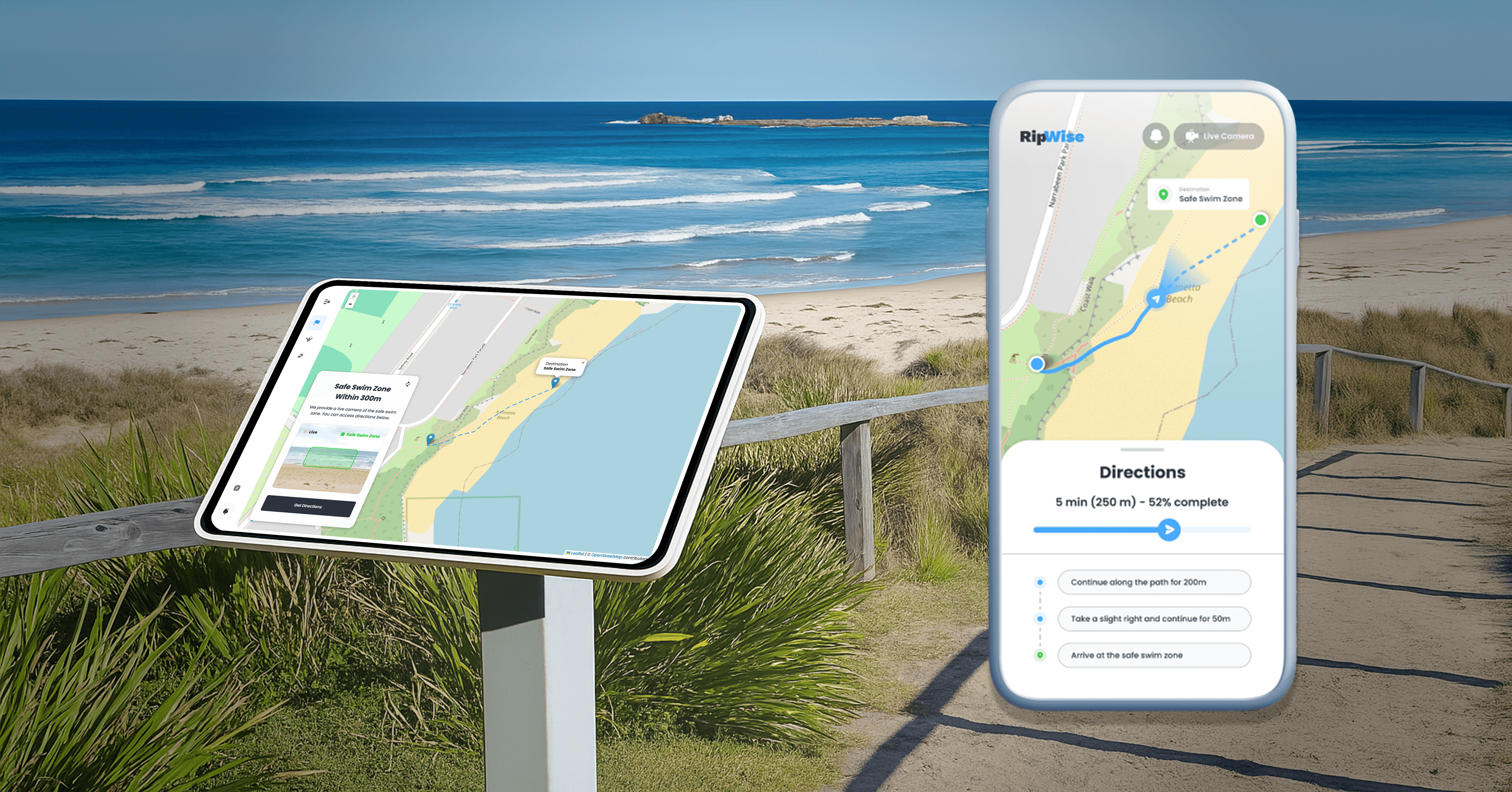
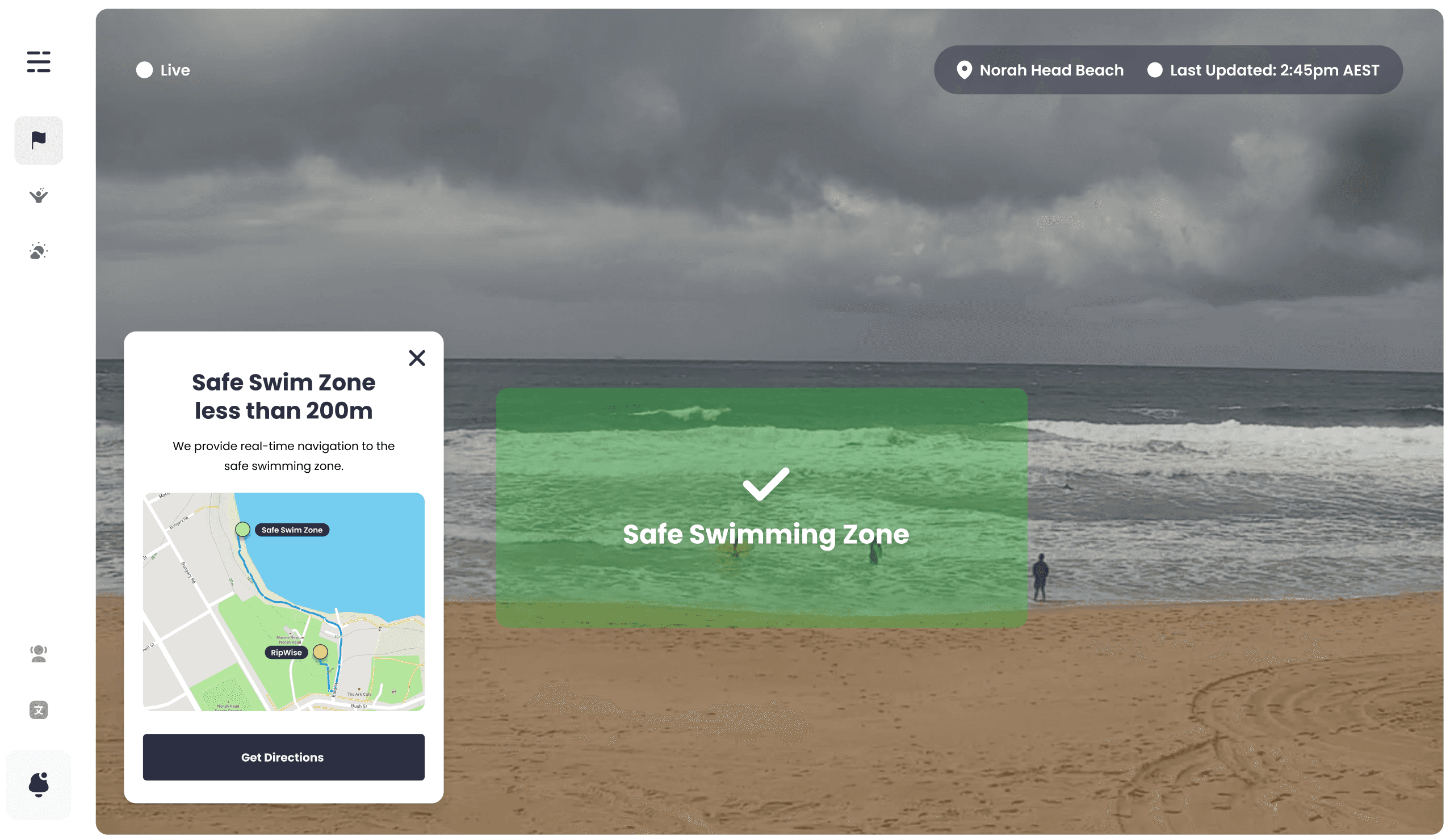
After exploring multiple directions, we landed on RipWise - a beach kiosk that uses camera vision and machine learning to identify the safest place to swim and guide users to that location via a live map. It also includes interactive education on rips and beach safety.
This idea built upon an initial animated digital signage solution, placing more emphasis on communicating the danger of being caught in a rip
It aptly addressed the danger of unpatrolled beaches
It sought to appeal to both our Primary and Secondary target audience through simple, interactive information that is visually descriptive
Next, we created wireframes. Our concept was tested and iterated on multiple times.
User Testing
As we tested early wireframes, some patterns became impossible to ignore:
Cognitive overload: Rushed beachgoers found the kiosk overwhelming - unsure where to look or what to do first.
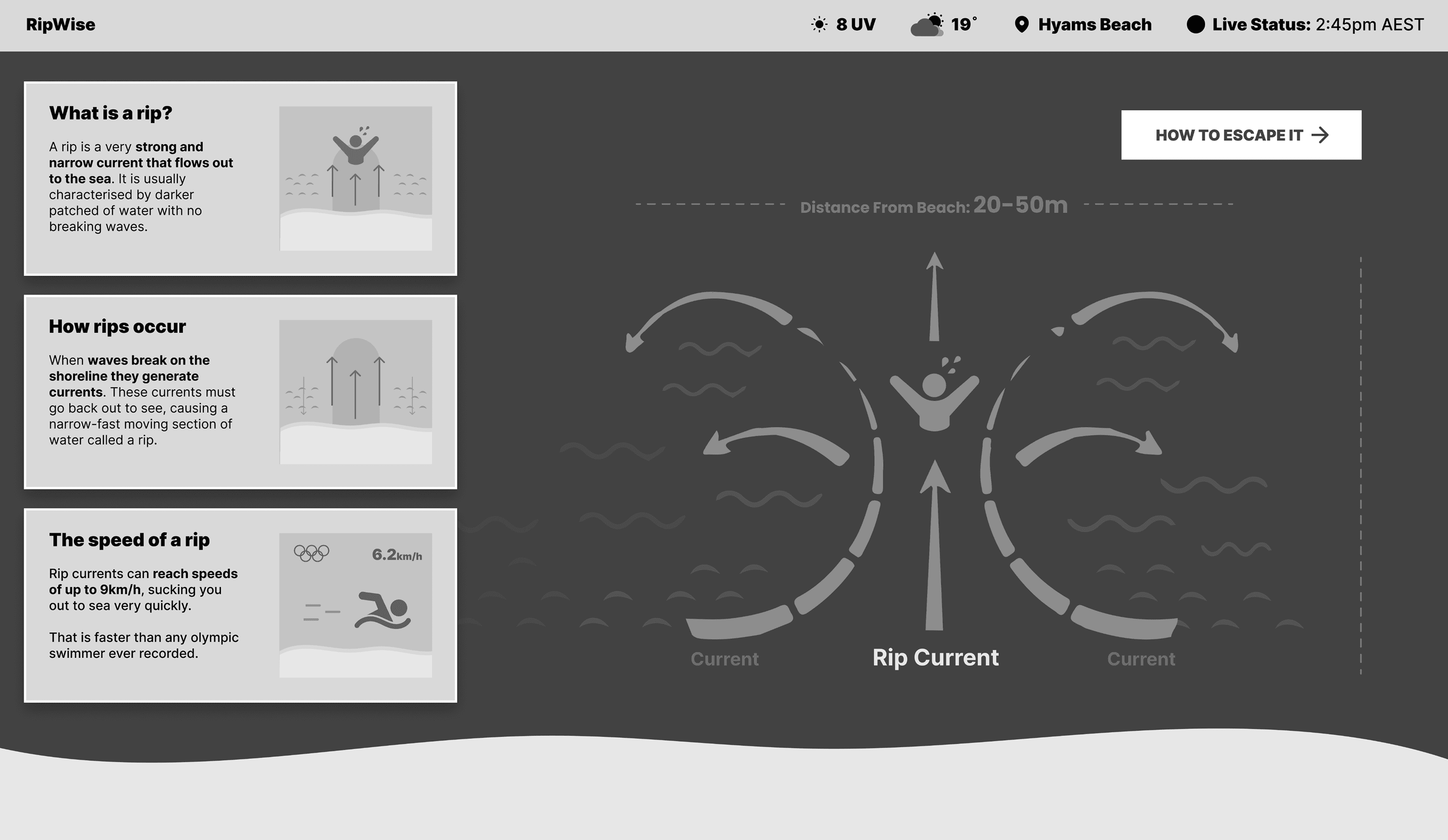
Critical gaps in recall: Even after engaging with the kiosk, many users still weren’t confident about how to escape a rip.
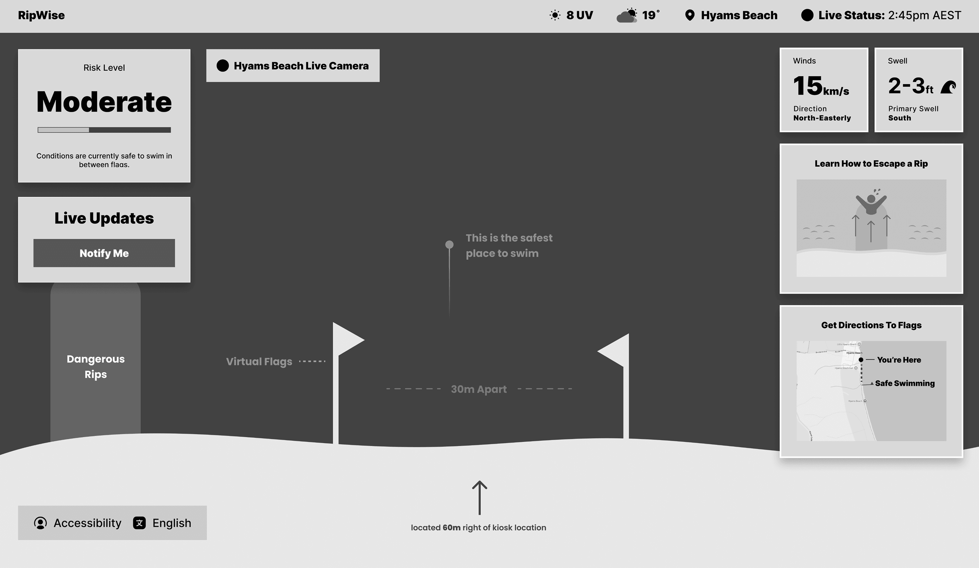
Concept confusion: The idea of “virtual flags” - a core navigational feature - wasn’t clicking. Users weren’t sure what it meant or how to use it.
What We Changed
To meet users where they were - often hurried, sun-drenched, and distracted - we overhauled the interface for speed, clarity, and visual flow:
Simplified homepage: We stripped it back to just one thing — where it’s safe to swim.
Visualise the rip info: “How to escape a rip” was rewritten for instant clarity, supported by a short, animated explainer.
Less clutter, more focus: All extra info (weather, UV, etc.) was moved to a secondary page to reduce distraction.
Evidence-led decision: A/B testing revealed that users consistently gravitated toward the live beach video, prompting us to prioritise it as the primary interface element.
Implementation
We then coded this into a webapp. The map and livestream views make it easy to visually locate the safest area, especially for users unfamiliar with beach hazards. A simple QR code lets people transfer directions to their phone without needing to type or share personal information. Live weather, UV, and wind data through an API help users make more informed decisions before entering the water. We also added a language toggle, currently supporting French, to better serve international visitors and those with limited English proficiency.
Outcome
Following the project, I assessed the feasibility and the potential impacts of Ripwise. Rolling RipWise out at 8-10 beaches a month would allow RipWise to cover 5–10% of Australia’s unpatrolled beaches. By targeting the most visited beaches, it is likely, drowning deaths at RipWise locations would drop up to 80%, potentially saving over 15 lives annually. It is likely that 50,000 beachgoers would engage with the kiosk each year. Currently less than 50% of beachgoers can correctly identify a rip. After interacting with our kiosk, over 80% of participants could correctly identify a rip. As such, we are likely to equip 20,000 people each year with valuable beach safety knowledge.